
Harm or damage from environmental events and disasters in Gauteng
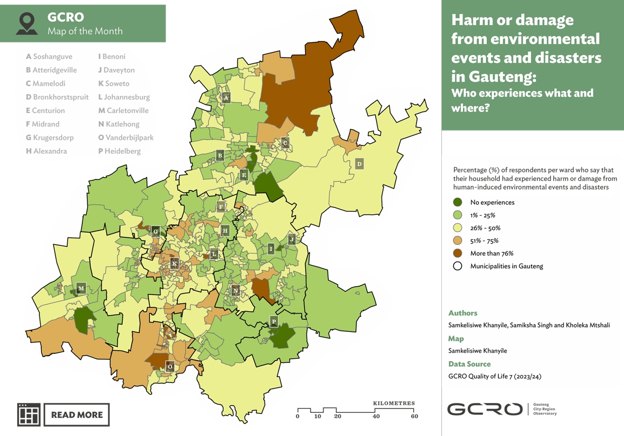
This GCRO Map of the Month examines the extent and spatial distribution of harm or damage experienced by households in Gauteng as a result of environmental events and disasters, using data from the GCRO Quality of Life 7 Survey (2023/24). The study found that 55% of respondents reported experiencing harm or damage from at least one environmental event or disaster in the year preceding the survey, with heat waves (27%), water and sewage pipe bursts (19%), air pollution (16%), and flooding (14%) being the most commonly reported impacts. The analysis distinguishes between naturally occurring hazards (such as flooding, heat waves, hail, lightning, and severe wind) and human-induced hazards (including air and water pollution, fires, sinkholes, tremors, and infrastructure failures). Results reveal significant spatial and socio-economic inequalities, with higher levels of harm concentrated in poorer communities, informal settlements, mining-affected areas, and historically disadvantaged townships such as Soweto, Evaton, and parts of the West Rand. The study highlights how climate change, ageing infrastructure, environmental degradation, and persistent spatial inequalities amplify vulnerability, underscoring the need for targeted disaster risk reduction and climate resilience measures across Gauteng.
Abstract based on original source.


Comments