South Africa’s climatic zones
Today, tomorrow
To design energy efficient buildings using an optimal combination of passive design strategies it is necessary to understand the particular climate designed for. To use energy simulation software such as EnergyPlus (TM), Ecotect (TM) or DesignBuilder (TM) to calculate building energy consumption or undertake a predictive thermal simulation of naturally ventilated buildings requires a detailed set of specially structured electronic weather data files such as the epw, tmy and iwec formats widely available in the USA. Unfortunately there is a lack of these in South Africa.
On the EnergyPlus (TM) website there are only two weather files available for South Africa in contrast to 1 479 for the USA. If the Meteonorm (TM) software is acquired a further 34 directly measured meteorological stations (weather files) are available for South Africa. Weather files for in between locations in the software mentioned are created by means of sophisticated interpolation formulas. Recently the South African SANS 204-2 standard introduced six main climatic zone region map in an attempt to inter alia establish the maximum energy demand and maximum energy consumption in the design of a particular building.
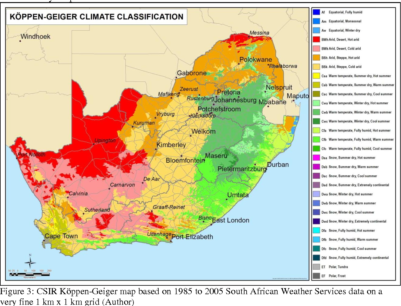
This was a first step to introduce a more quantified view of climate regions into the South African National Building Standards. The question is raised whether this approach is adequate to optimally support medium to long term design decisions within the built environment for simulating and quantifying passive design strategies such as natural ventilation, thermal mass and passive solar heating. As a first stage to address this shortcoming it was decided to create a highly detailed climatic map of South Africa using 20 years of precipitation and temperature data using a Köppen-Geiger climatic classification to provide better general insight than the six-zone model. After this the predicted climate change over the next 100 years expressed as Köppen categories was researched.

Comments