Log in

Create a user profile using your existing professional profile on LinkedIn, Academia, or ResearchGate.


Alternatively, register a username and password to start an account.


By creating an account you will be able to contribute articles, engage in discussion groups, network with fellow professionals and businesses, and receive interest-related alerts.

Forgot Password

Please enter your email address below and you will receive a temporary link to re-activate your account

Assessment of spatial data infrastructures

Article image

Antony K Cooper, Elsona van Huyssteen, Sonali Das, Maria Coetzee, Gerbrand Mans

12 December 2014

English

Antony Cooper

Journal article

Council for Scientific and Industrial Research

South Africa, India, China, Brazil, Australia

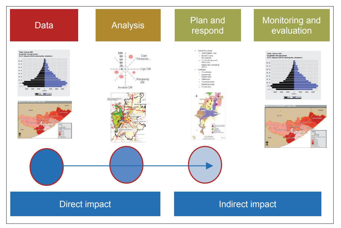
A Spatial Data Infrastructure (SDI) is an evolving concept, essentially consisting of policies, institutional arrangements, Geographical Information Systems (GISs), data bases, networks, Web services and portals to facilitate and coordinate the availability, exchange and sharing of geospatial data and services between stakeholders from different levels. This article aims to provide some information on the role and value of SDIs and their potential relationship with, and contribution to other geospatial and evidence-based tools and technologies within the South African planning context and system. For this, it provides a brief overview and comparison of the key characteristics of the SDIs in South Africa, China, Brazil, Australia and India. The article highlights some of the complexities and use of an SDI and the value of, and need for an SDI to support the spatial and land development planning envisaged in the Spatial Planning and Land Use Management Act (SPLUMA).

Downloads

Website References

Address

Australia

Brazil

Built environment

Cadastres

China

Cities and towns

City planning

Cost sharing

Data analysis

Data quality

Environment

Geographical information systems

Geomatics

Governance

Housing

Human settlements

ICT

India

Integrated regional development

Integrated rural development

Land

Land

Land cover

Land information systems

Land use

Land use planning

Legislation and standards

Lineage

Mining

Municipalities

Other

Planning and management

Policy

Population

Provinces

Public administration

Regional planning

Remote sensing

Research

Rural planning

Society

South Africa

Spatial analysis

Town and country planning

Transport

Urban and Regional Dynamics

Urban planning

Water

Zoning

View Contributors:

Comments

No comments available
LOAD MORE