
Modelling the spatial distribution of Hepatitis A
Risk, based on wastewater concentrations in Gauteng
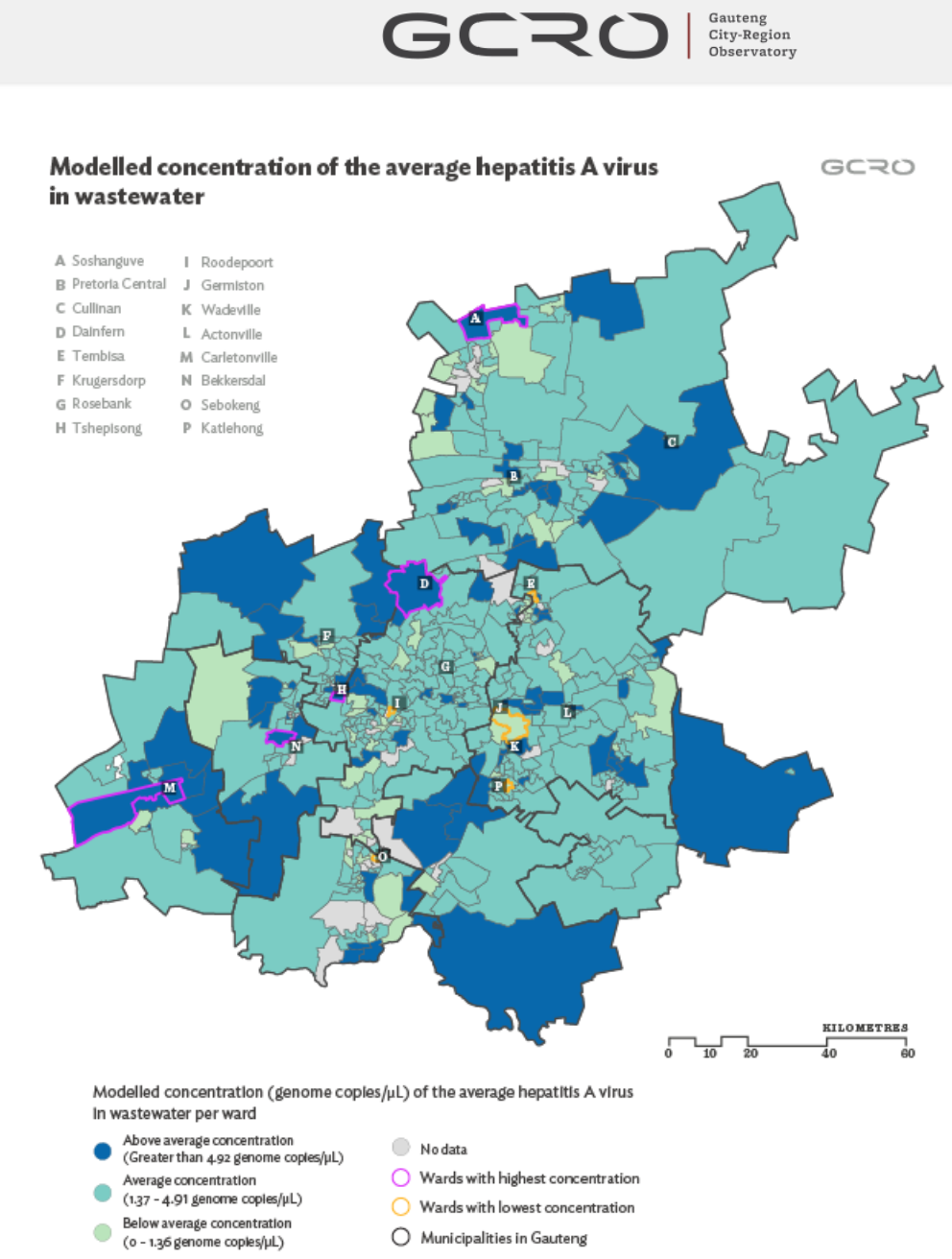
This study uses wastewater surveillance, clinical case data, and socio-economic indicators to model the spatial distribution of Hepatitis A Virus (HAV) risk across Gauteng. It demonstrates how wastewater and environmental surveillance can complement traditional clinical surveillance by identifying infections that may otherwise go undetected, particularly among asymptomatic populations. Using machine learning techniques, the authors identify areas of higher predicted HAV risk and show that communities with limited access to basic services, inadequate refuse removal, alternative water sources, and informal housing are generally more vulnerable to infection. The findings provide a spatially informed tool to support targeted public health surveillance, prevention, and intervention efforts across the province.
Abstract based on original source.


Comments