The Settlement-Mesozone Geo-Frame
An evolving spatial data framework facilitating data integration in support of South Africa’s development planning
20 April 2026
International Journal of Cartography
English
Journal article
Council for Scientific and Industrial Research
Africa
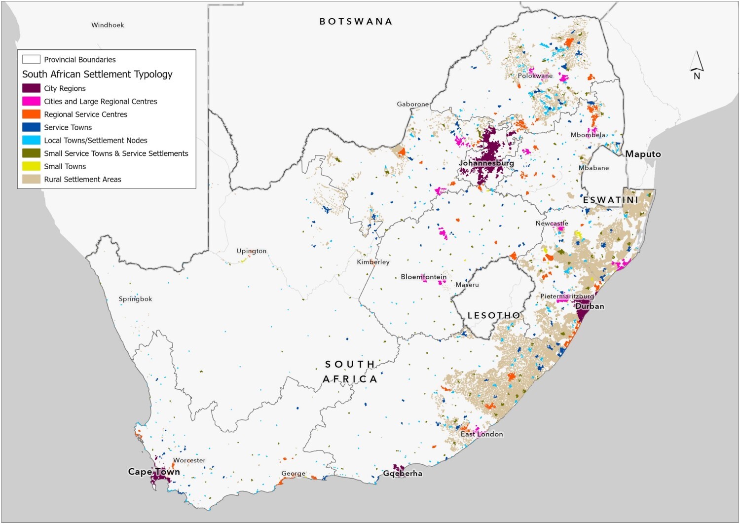
In the development planning domain, there is a critical need for enhanced understanding of the complex spatial dynamics of social, economic and environmental patterns. Data are a critical resource for evidence-based planning and decision-making, and the 2030 Agenda for Sustainable Development has underscored the need for harmonised data of increasingly high quality, accuracy, currency, timeliness and granularity to effectively measure and monitor progress towards the Sustainable Development Goals at global, regional, national and subnational levels. Integrating geospatial and statistical data is one of the most effective ways to maximise its value, and while data integration methods are well documented and widely applied, less attention has been given to determining the most suitable spatial units for publicly useable, policy-informing data. A key challenge lies in the varying units of analysis and geographical scales employed across sectors and scientific disciplines. In South Africa, the Settlement-Mesozone Geo-Frame was developed and has evolved over 20 years of focused research and development to address issues inherent in the geographically arbitrary administrative areas according to which official data are collected and reported. The geo-frame provides a robust foundation for integrating spatially misaligned national datasets, enabling better profiling, mapping, analysis and monitoring of places over space and time.
Abstract based directly on original source.


Comments